
Perryman Ditch Master Drainage Plan
City of Tulsa, Oklahoma
The Perryman Ditch Study began in 2017 and is broken into two study regions: Perryman Ditch North and Perryman Ditch South. Perryman Ditch North and South are predominantly flat low-lying areas with overland flooding that generally drains south and west to the Arkansas River. The City of Tulsa provided 2015 LiDAR topography which was utilized for this study. The 2017 study contains both 1-Dimensional and 2-Dimensional modeling.
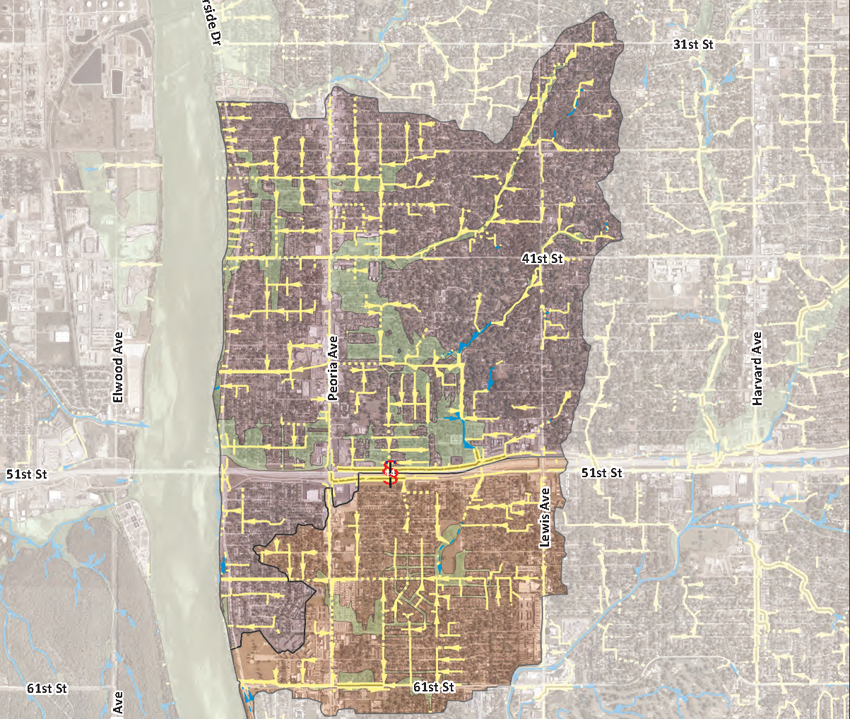
Perryman Ditch North is generally located along the east side of the Arkansas River, bound to the south by Interstate 44, bound to the north by E. 31st Street, and bound to the east by S. Columbia Place. Perryman Ditch South is generally located along the east side of the Arkansas River, bound to the north by Interstate 44, bound to the south by E. 61st Street, and bound to the east by S. Lewis Avenue.
The Perryman watershed contains a large amount of closed storm sewer systems which include hundreds of storm sewer inlets. In the low-lying flat areas, 2D modeling was required to best represent the resulting floodplains. Additionally, the storm sewer pipes and inlet capacities needed to be analyzed to determine how much storm water was conveyed through the storm sewer and how much contributed to the overland floodplains.
A software known as PCSWMM (Personal Computer Storm Water Management Model) simplifies complex hydrologic/hydraulic modeling which can include 1-D, 2-D, and closed storm sewers. PCSWMM was utilized in the analysis of both Perryman North and Perryman South.
The resulting 2D analysis for Perryman North included 119 sub basins with an average area of 16 acres and a combined 2.98 square miles of drainage area. Perryman South 2D analysis included 28 sub basins with an average area of 27 acres and a combined 1.19 square miles of drainage area.
The study included the development of alternatives to mitigate the drainage and flooding issues that existing within the watershed. Cost estimates were developed for each of the alternatives and a recommended plan was selected for each of the problem areas. Exhibits were created for each of the recommended plans that showed schematics of the improvements along with the estimated costs.

