Tribal Complex Flood Study and Master Drainage Plan
Citizen Potawatomi Nation, Oklahoma
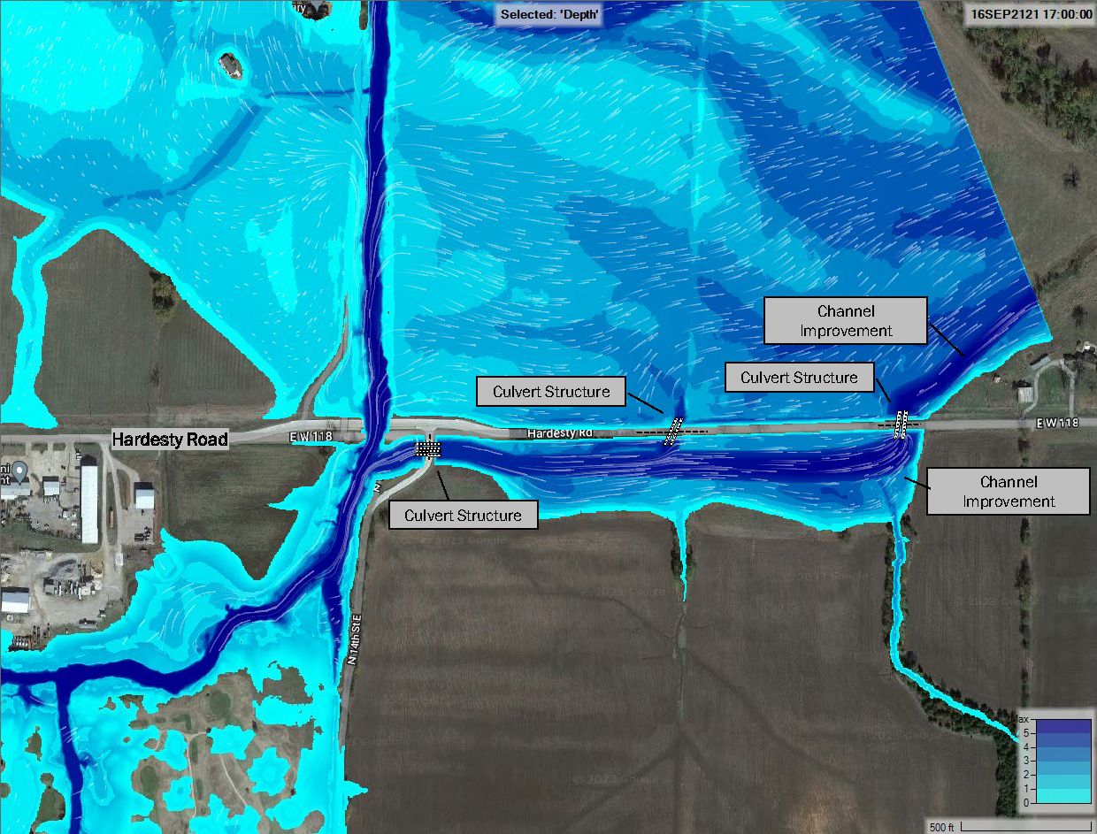
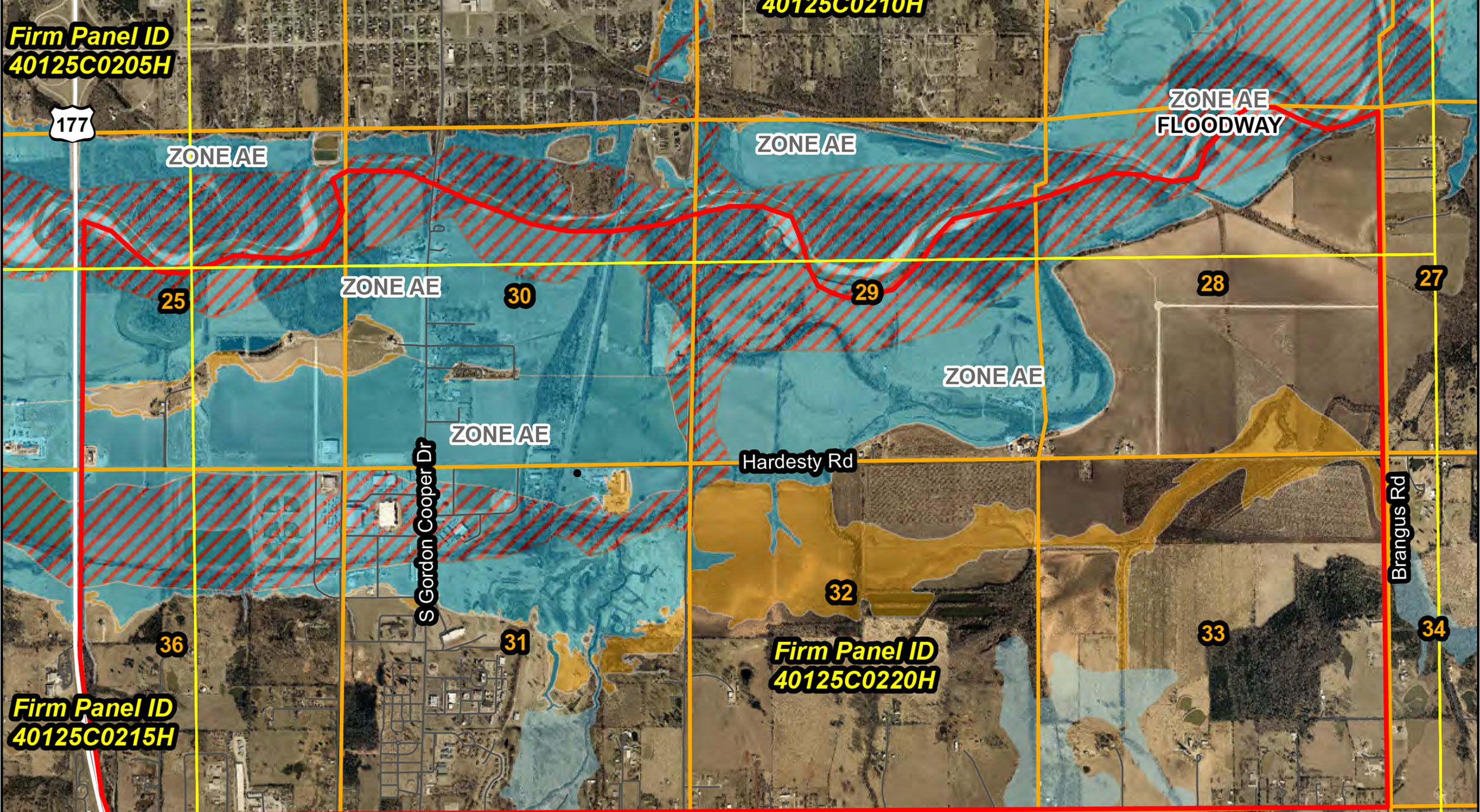
In 2021, Meshek was chosen by the Citizen Potawatomi Nation to conduct a flood study of their tribal complex. This study updated flood hazard data, remapped regulatory floodways, established special flood hazard area boundaries and base flood elevations, and created conceptual flood hazard mitigation options, all of which met FEMA standards. The study area encompassed the Tribal Complex Area from the Lower Reach of the North Canadian River south to Benson Park Road and SH 177 east to Brangus Road.
The updated modeling and mapping were submitted to FEMA as a Letter of Map Revision. Future grant opportunities can be utilized to obtain funding to facilitate the implementation of the mitigation actions that were developed during the studies.
Our work for the Nation would go on to include a master drainage plan for Squirrel Creek, completed in 2024, to study the flooding concerns on the Nation’s properties there. This study utilized a combination of 1D and 2D methods, and revealed that the Squirrel Creek flow rates east of U.S. Highway 177 should be significantly reduced compared to the effective FEMA flow rates due to the highway embankment preventing the full Squirrel Creek flow from continuing east. Our report also included recommendations for pursuing grant funding to mitigate frequently flooded locations.